|
Since our previous activity update on this matter in October 2017, all indications are that the Department of Veterinary Services has now abandoned its 2016 plans for the construction of a new 68km "protection zone fence" along the eastern boundary of wildlife management area NG5 (see Map). KWT, on a completely unsupported (pro-bono) work basis, has played a crucial role in achieving this outcome: As the only conservation organization that actively participated as an interested party in the environmental authorization application process for this proposed development, as overseen by the Department of Environmental Affairs (DEA), KWT provided crucial input by way of its independent submitted reports and contributions to DEA reference group meetings, relating to, for example: - Inadequancies in the stakeholder consultations and environmental studies related to the EIA undertaken on behalf of DVS by their appointed Consultants; - Data on the movement of wildlife across the existing, dilapidated Setata Fence, by way of intensive spoor based surveys (February and June 2017) carried out in partnership with Round River Conservation Studies and Wildlife Act respectively, proving the likelihood that the new fence would severely constrain and injure migratory wildlife; - Evidence of impacts of fencing on wildlife from the previous alignment of this fence across NG5, which was partly dismantled in 1998 and then fully removed in 2004 due to the lobbying efforts of KWT's founding Trustee; - Evidence of lack of monitoring of livestock movements across the existing Setata Fence and the ineffectiveness of fencing in this area as a disease control measure, especially considering that the western portion is situated in a waterless wildlife habitat area far from any cattleposts. Throught these technical inputs and regular advisory support to DEA, the Consultants were effectively compelled to "go back to the drawing board" in terms of the conceptualization of the project and have been unable to generate the revised studies requested by DEA since October 2017. The elapsed time has now expired the EIA process and DVS has abandoned its efforts to obtain authorization. The outcome of this is that a major environmental catastrophe has been averted, as the development, inter-alia, would have resulted in: - The deforestation of at least 170 hectares of natural vegetation by way of a 68km X 25m bulldozed cutline; - Movement obstruction of elephant, giraffe, zebra, eland, gemsbok, kudu, ostrich and many other species, and physical stress due to the inability of wildlife to move freely to food and water supplies within their territorial ranges; - Injury and mortality of potentially hundreds of wild animals due to entanglement with the new fence in attempting to run, jump or crawl through it; - Further loss of wildlife due to poaching along new roads that would be located on either side of the new fence-line, in an area that is currently protected from most human disturbances by having no access roads. 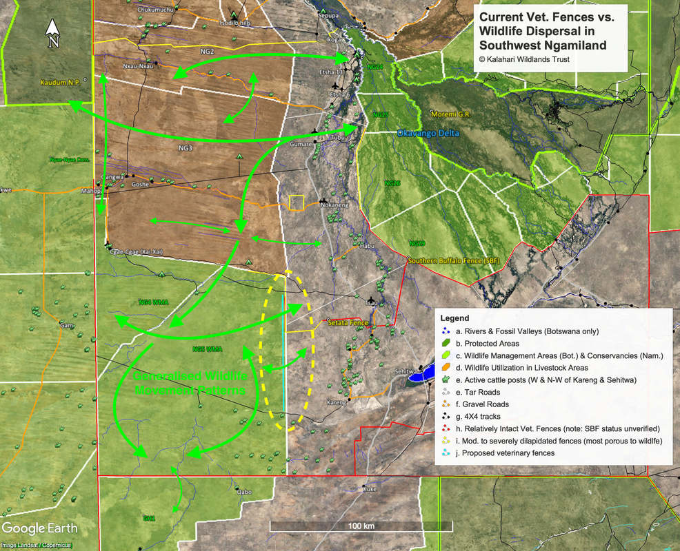
0 Comments
Leave a Reply. |